-
AI in Photoshop

This video demonstrates the new AI feature in Photoshop using a demo with an image from Pixels.
Translated by
 VideoTeacher
 -
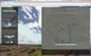
How do I view Mars and the moon on Google Earth?

Discover our moon and planet Mars on Google Earth.
Translated by
VideoTeacher, Other -
Let the sea level rise in Google Earth

On the basis of this instruction you can a teacher make the sea level rise in Google Earth.
Translated by
VideoTeacher, Other -
Using Odyssey.js: Explanation Video

Odyssey.js is a free tool to add text, integrate photos and interactive maps together to create a digital story.
This video explains how you can create a story Odyssey.js. Students can place on a map and write a text about it. There is also the …
Translated by
VideoTeacher -
Relief: Flipping the classroom

This video explains in six minutes from the significance of relief and how it is displayed on the map. There is greater emphasis on:
- slope;
- contour;
- contour interval;
- altitude and altitude rate;
- altitude zone;
- legend.
Translated by
Video (17)Teacher -
Google Street View: Hyperlapse tutorial
The Street View feature in Google Maps is a handy tool, including useful in teaching geography. But you still can use this panoramic photos much more proves the design Teehan + Lax (Toronto). They made Street View imagined n hyperlapses …
Translated by
VideoTeacher -
Teachem: Make YouTube videos interactive

TEACHEM is a free web tool that lets you search YouTube videos can convert online lessons can be private or public. A variety of additional teaching and learning resources, such as Flash cards and SmartNotes make it a unique and powerful tool for …
Translated by
VideoTeacher -
Explain Everything: Making an instructional film with the iPad

With the Explain Everything app you can easily create an instructional video via the iPad. You can easily export the video you make with Explain everything to the Photo Roll, Youtube, Dropbox, among others. You can then share that link with your …
Translated by
VideoSchoolboard, ICT co-ordinator -
Visually compare the surface of countries

Sometimes it's hard to explain how small Belgium is facing a country like Australia. The website If It Were my home there is a response.
This screencast you get to know the potential of this site.
You can not only compare the size of two …
Translated by
VideoTeacher -
Klimatogram

This tutorial explains about klimatogrammen both theory and exercises.
Translated by
Video (12)Schoolboard, ICT co-ordinator
Yummmm… cookies!
We don't like being tracked either. That's why we're concerned about your privacy.
Necessary cookies: for the proper operation of the website.
Functional cookies: for your convenience. recommended
Social media cookies: to view embedded media such as videos from YouTube, Facebook … recommended
Statistical cookies: for anonymous data collection to enhance user experience.