-
Farm Animals: Webquest

In this webquest you will find various assignments that the students can do independently. The theme is farm and the assignments consist of:
- a photo series for the children to talk about;
- two places in which the students have to find ten …
Translated by
 Interactive exerciseStudent (not teacher training)
 -
How do I view Mars and the moon on Google Earth?

Discover our moon and planet Mars on Google Earth.
Translated by
VideoTeacher, Other -
Let the sea level rise in Google Earth

On the basis of this instruction you can a teacher make the sea level rise in Google Earth.
Translated by
VideoTeacher, Other -
Create your own digital bulletin board around a theme

This movie explains how to create an online bulletin board with Padlet.
The sample is collected digital picture books on the theme shudder.
Translated by
VideoTeacher, ICT co-ordinator -
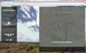
Using Odyssey.js: Explanation Video

Odyssey.js is a free tool to add text, integrate photos and interactive maps together to create a digital story.
This video explains how you can create a story Odyssey.js. Students can place on a map and write a text about it. There is also the …
Translated by
VideoTeacher -
Relief: Flipping the classroom

This video explains in six minutes from the significance of relief and how it is displayed on the map. There is greater emphasis on:
- slope;
- contour;
- contour interval;
- altitude and altitude rate;
- altitude zone;
- legend.
Translated by
Video (17)Teacher -
You've got the power: Serious game energy transition

With the serious game You've got the power , students can get started with the sustainable energy theme.
With You've got the power , students experience the impact of the choices made by parties involved in the energy transition. They …
Translated by
Interactive exercise (3) -
Google Street View: Hyperlapse tutorial
The Street View feature in Google Maps is a handy tool, including useful in teaching geography. But you still can use this panoramic photos much more proves the design Teehan + Lax (Toronto). They made Street View imagined n hyperlapses …
Translated by
VideoTeacher -
Teachem: Make YouTube videos interactive

TEACHEM is a free web tool that lets you search YouTube videos can convert online lessons can be private or public. A variety of additional teaching and learning resources, such as Flash cards and SmartNotes make it a unique and powerful tool for …
Translated by
VideoTeacher -
My 2050: Simulate your scenario for a low-carbon society by 2050

The service Climate Change Federal Government has launched in collaboration with WWF, an educational tool. With My 2050 students can simulate their own scenario for a low-carbon society by 2050.
We all know that our society is enormous challenges …
Translated by
Interactive exercise (5)
-
Visually compare the surface of countries

Sometimes it's hard to explain how small Belgium is facing a country like Australia. The website If It Were my home there is a response.
This screencast you get to know the potential of this site.
You can not only compare the size of two …
Translated by
VideoTeacher -
Klimatogram

This tutorial explains about klimatogrammen both theory and exercises.
Translated by
Video (12)Schoolboard, ICT co-ordinator
Yummmm… cookies!
We don't like being tracked either. That's why we're concerned about your privacy.
Necessary cookies: for the proper operation of the website.
Functional cookies: for your convenience. recommended
Social media cookies: to view embedded media such as videos from YouTube, Facebook … recommended
Statistical cookies: for anonymous data collection to enhance user experience.